A 17 km megalithic mystery tour; the Špičák and Kounov stones
- Bohemia is not well known for its megaliths (prehistoric stone monuments). This walk might change that perception. Deep inside the forests of the Džbán nature reserve, on a broad ridge above the village of Kounov, more than two thousand quartzite stone boulders have been arranged in a mysterious series of fourteen parallel rows running north to south. No-one knows who created the arrangement, or why. Theories suggest the stones might from some form of prehistoric astronomical system, or an ancient ritual area (possibly even a racetrack or maze).
- Just to north of the stones, on the same broad plateau area, is a strongly fortified iron age hillfort – Hradiště Rovina – dating from the 6th century BC. There are indications the site was also used in late Bronze and Stone Ages. Curiously, there are few signs the site was used extensively for residential purposes. Although there is no clear archaeological linkage between the hillfort and the stone rows, the proximity is suggestive. It is believed the plateau area was free of forest when the hillfort was occupied in the Iron Age – this would have enabled direct line of site between the stones and the fortress.
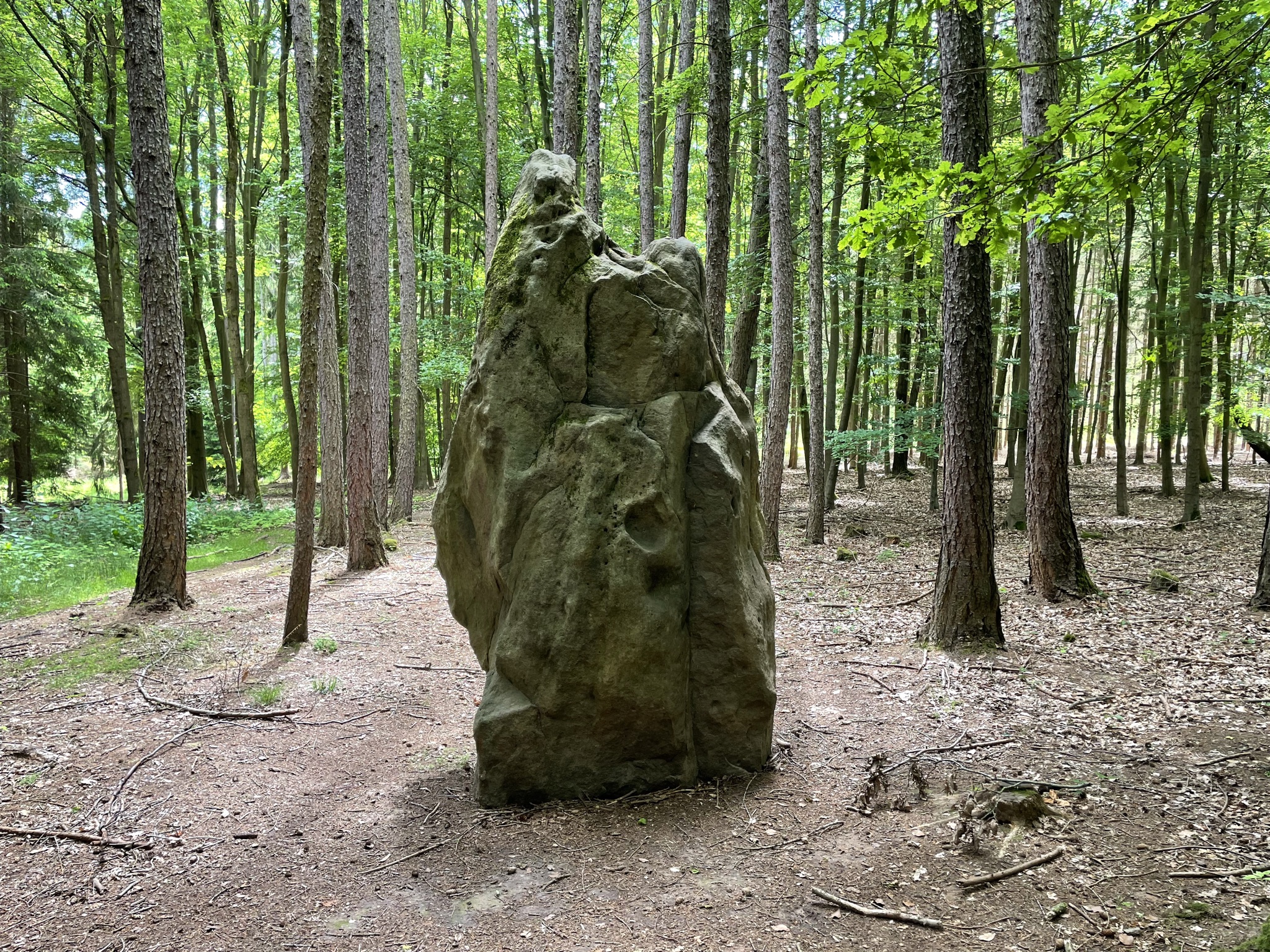
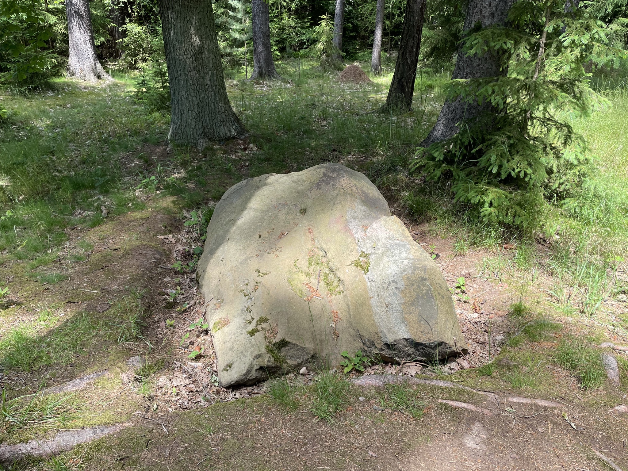
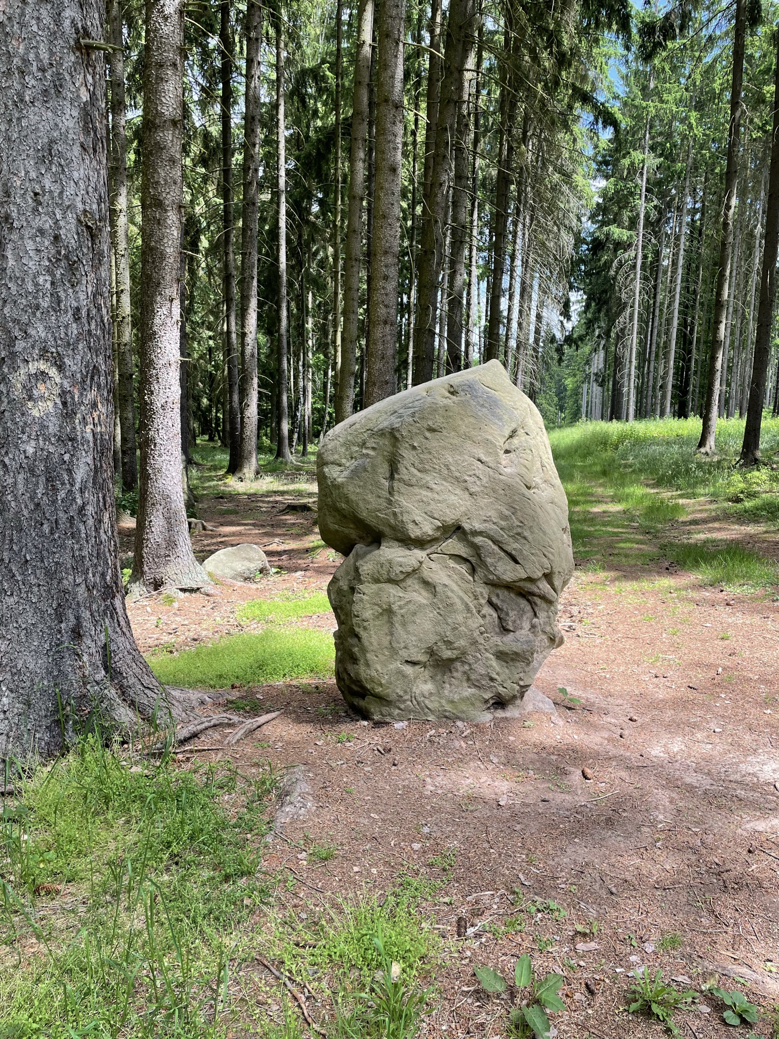
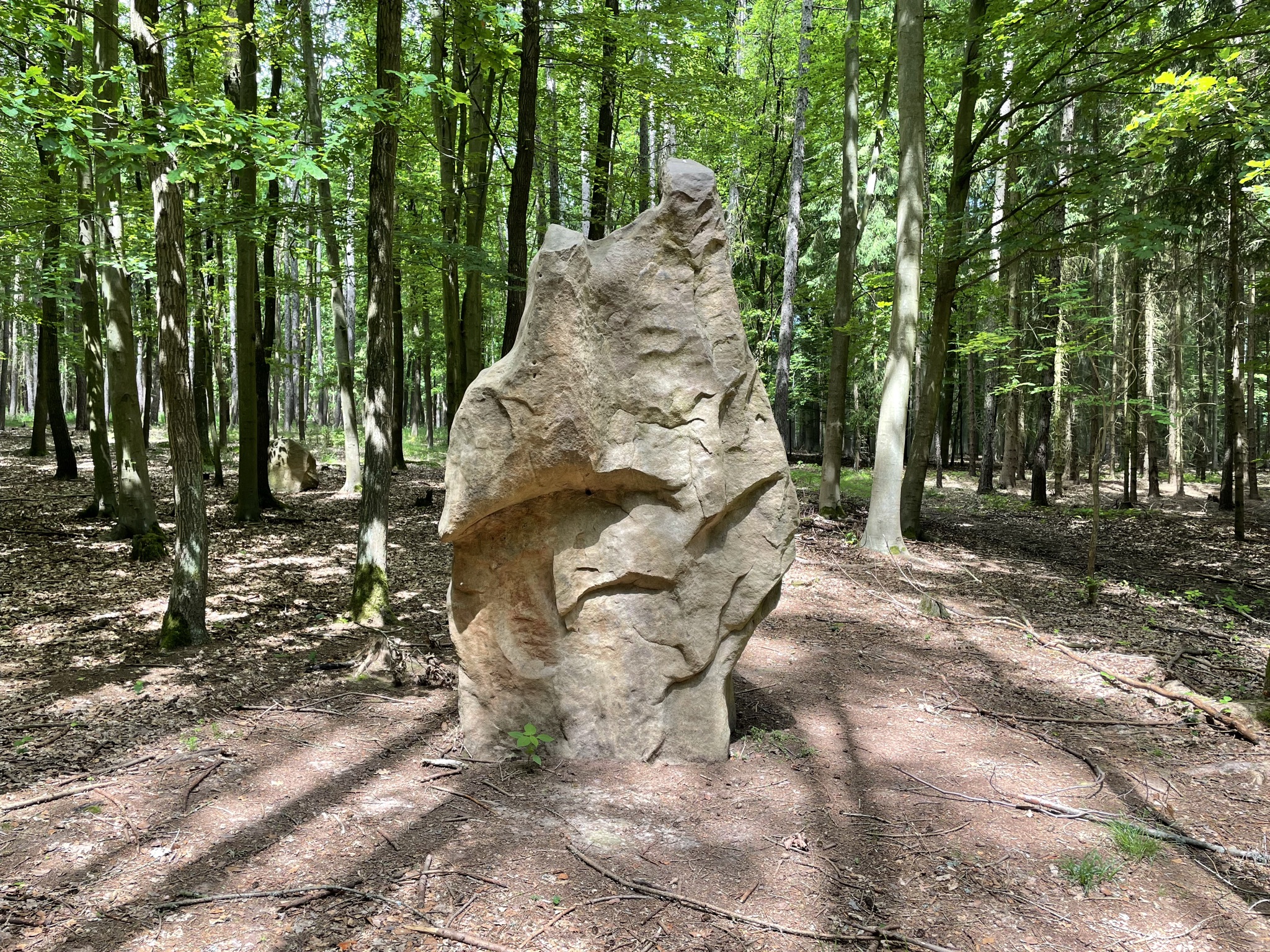
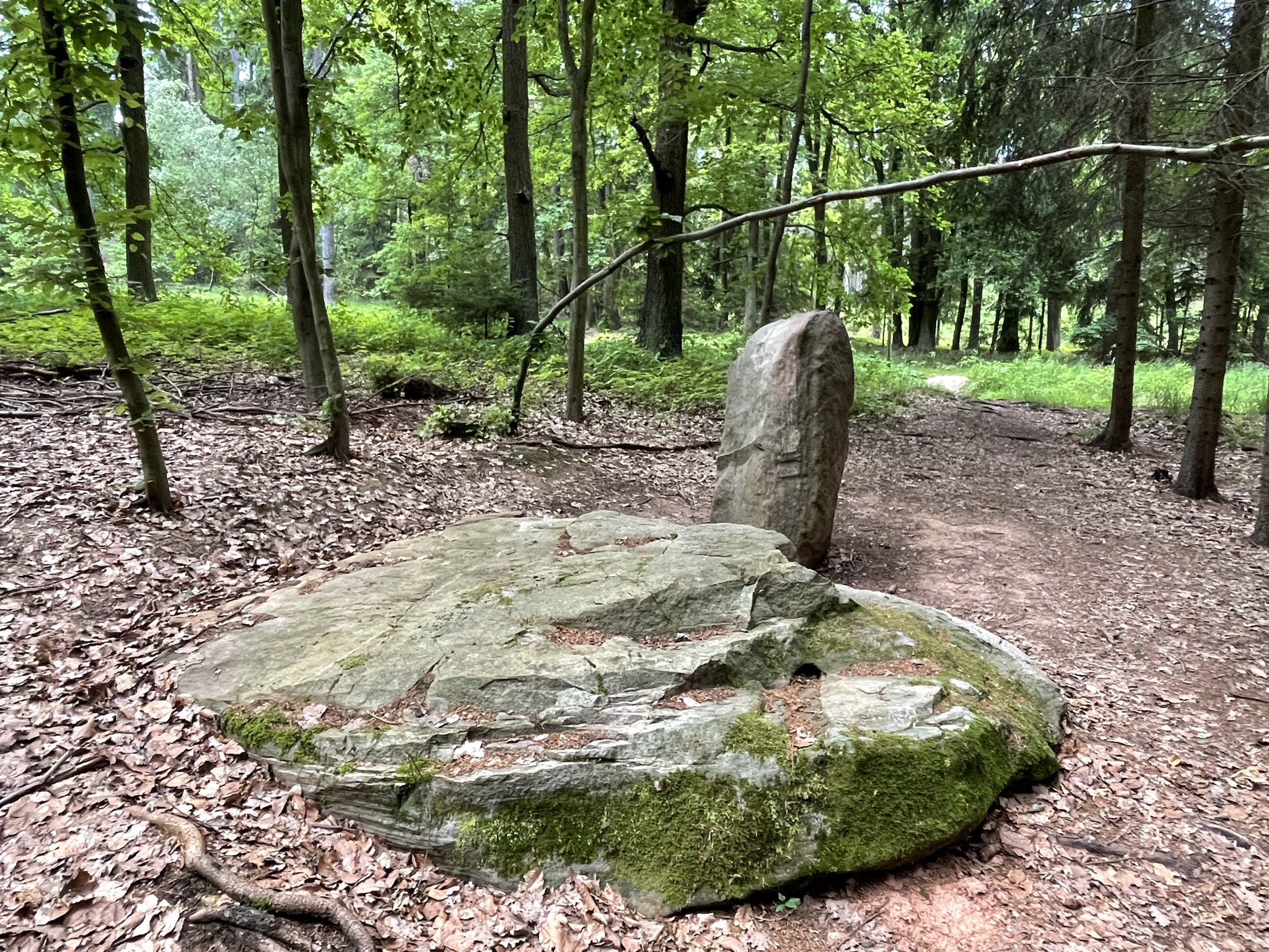
- In the broad valley just to the west of the Rovina hillfort, just below the unusual conically-shaped hill of Špičák, a second megalithic mystery awaits discovery. A series of apparently toppled menhirs (standing stones) lie partly buried in the sandy soil. Some of the menhirs have been restored to their original positions in recent years by enthusiasts. As with the Kounov stones, the question of who originally erected the Špičák menhirs (and possibly other nearby megalithic monuments including a stone circle) remains a complete mystery. It is hoped that in the future modern archaeologists will take a fresh look at at the area to try to uncover some of its secrets.
- The Kounov and Špičák stones can be reached relatively quickly from Mutějovice railway station (which also has a parking area just next to the railway line), where a short educational trail to the Kounov stones begins. A varied circular route traverses the two megalithic stone areas, approaches the village of Pnětluky and then climbs up to a promontory on which the significant 15th century ruins of the moated Pravda castle are situated. The large grassy courtyard inside the ruined walls is a good spot for a picnic.
- From Pravda castle there is an optional 2km nature trail in the forest, visiting some unusual sandstone rock formations. The return route passes under the hillfort of Rovina before returning to Mutějovice station past the Kounov stones again.
- The total route (including the optional forest circuit at Pravda castle) is 17.5 km with 440m of height gained/lost on the journey. Most of the trail is on easy forest footpaths, but there are a couple of steeper sections. There are no refreshment options on the route – so perhaps take a picnic to eat in the castle courtyard.
- Note: A short exploration of the Špičák stones is possible even with a stroller, by parking at the small area just off the public road near the stones (map point 6) and from there walking along the forest road through the stones area for 1-2 km. The best stones, however, are located 100 /200m away from the main track.
Note: click ‘Show on Mapy.com’ to go to a full screen version of the route directly on the mapy.com site. This can be used for on line navigation, saved or exported as a GPX file.
Directions
- Start the walk at the Mutějovice railway station trail signpost – there is also an introduction board for the Kounov stones trail
- Join the YELLOW trail and climb up to the plateau. After 1.9km the first rows of Kounov stones appears on the right side
- Continue on the YELLOW trail to reach the Rovina trail junction after 900m. Here join the BLUE trail in the direction of Špičák
- After 1.4 km reach the Špičák trail signpost. Continue on the BLUE trail to the start of the the Špičák stones area which is reached in 400m (note – just before reaching the first stones there is a wooden marker to the parking area)
- Some of the stones are marked with wooden signposts, but others still have yet to receive markers – to find the best stones in the forest it is best to use the mapy.cz application which has several of the stones marked on the interactive map. The largest stone so far erected – the ‘king’ stone is marked as map point 8 above
- After exploring the stones area, continue on the BLUE trail as far as the U dubu trail signpost and here turn right onto the GREEN trail in the direction of Pnětluky (note: it is possible to make a short cut by taking the forest track at map point 9 and joining the GREEN trail later – this saves a section walking in the long grass)
- On reaching Pnětluky village continue on the GREEN trail in the direction of Pravda. The trail climbs steeply up to the K Čertovu kameni trail junction. Continue uphill on the GREEN trail for a further 400m to reach the Pravda castle ruins – take the bridge across the moat to visit the large courtyard area
- At Pravda, decide whether to take the (recommended) 2 km educational trail to the sandstone rock area, including the well known Čertův kámen. After completing the (anti clockwise) circuit return back to K Čertovu kameni trail signpost
- If not undertaking the extra 2km loop, return back to the K Čertovu kameni signpost and join the BLUE trail in the direction of Rovina
- This trail passes beneath the site of the Rovina Iron Age hillfort after 1.9 km and reaches the Rovina trail junction in a further 600m
- At Rovina return back to Mutějovice train station on the outbound YELLOW trail. The station is reached in 2.9 km